
Finding North Carolina Neighbors Around One Address
North Carolina has no single block roster that names every person living around an address. The useful public trail combines a map with the custodian that keeps each parcel, case, or recorded instrument. A nearby parcel is a geographic neighbor, while its tax owner may live elsewhere. A voter record is about one named registrant, and an association directory reflects a local group rather than every household. Start with the county and municipality so the map, tax card, and deed point to offices with the right jurisdiction.
| Source | What It Shows About a Block | Access |
|---|---|---|
| NC OneMap or county GIS | Parcel lines, roads, jurisdiction layers, PINs, and links to owner records | Free map; detail and refresh date vary |
| County assessor or tax roll | Owner, situs and mailing address, value, exemptions, and parcel details | County portal or office counter |
| Register of Deeds index and plat | Recorded parties, deed chain, subdivision, lot, block, or covenant reference | Local index, images, copies, or counter |
| NCSBE voter profile | A named registrant's status, polling place, districts, and history | Free name search; no public block browser |
| Permit or code record | Public work or case activity associated with an address | City or county portal or records request |
| Neighborhood organization listing | Group name, area, public contact, or meeting route when posted | Municipal program; no statewide member list |
For land questions, the NC OneMap viewer supplies a statewide parcel and geography starting point, while the county assessor remains the source for its tax-card detail. The NCARD county directory can route a deed question to the local Register of Deeds. Each result has limits: tax ownership does not establish current occupancy, and public record access does not turn a map into a census of North Carolina neighbors.
Mapping North Carolina Neighbors With Adjacent Parcels
NC OneMap standardizes parcel geography across all 100 North Carolina counties, but the statewide layer is a starting point, not a substitute for a county tax card. The GIS task is to move from one known address to the parcel lines around it, then confirm the ownership fields with the county that maintains those records. A buffer or radius tool can help select nearby features when offered; it does not define an official neighborhood boundary or block.
The NC OneMap GIS viewer provides the statewide parcel and map starting point for this North Carolina neighbors lookup.
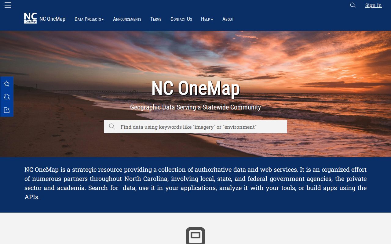
Use the map to find parcels around a known location, then confirm the county tax and deed details before drawing a conclusion.
- Set the county and municipality from the address; check the postal city separately.
- Search NC OneMap or the county GIS by address or parcel ID, then zoom until lot lines and roads are clear.
- Record the target parcel PIN and legal description before clicking nearby lots.
- Click lots that share a boundary or face the same block, and note each parcel's PIN, situs, mailing address, and subdivision field.
- Open the assessor card and deed or plat index for the county record behind each map result.
- Keep the map refresh date and stop at the surrounding area you can verify; for a complete street chain, use the North Carolina street directory method.
Address labels and map placement can be approximate. A parcel may cross the edge of a named subdivision or sit near a municipal boundary, so preserve both the displayed address and the recorded legal description. When a county's website has a different tool name or its state layer looks old, use the local GIS and assessor portal for the final check.
For a Raleigh or Wake County example, Raleigh/Wake iMAPS provides local parcel viewing with identify and layer tools. Use its map for a closer parcel check, then confirm ownership and dates with the assessor or Register of Deeds.
North Carolina Neighbors and Voter Profiles
The State Board of Elections offers a free NCSBE Voter Search by a person's name. The public profile may show registration status, precinct, polling place, voting districts, sample ballot when available, absentee-ballot details when available, and voter history. It is useful to confirm one named registration after a map search, but it does not expose a public browse for all voters at a street or on a block.
A request for a full voter file follows a separate route through the State Board or a county board and remains subject to election-law limits. The research did not locate one current statewide request form or fee. SSNs, protected information, and ballot choices are not public profile fields. If a result does not appear, ask the relevant Board of Elections about a correction or public-file process rather than assuming no one lives at that address.
North Carolina Neighborhood Directories Start Locally
North Carolina has no central directory of every neighborhood association, HOA, block club, congregation, or civic group. Start with the city's neighborhood office, planning or community-engagement pages, then check the group's own public contact route. The research identifies Raleigh, Charlotte-Mecklenburg, Durham, Asheville, and Wilmington/New Hanover as places with local neighborhood or civic-association resources. Those city examples do not cover all counties or every group.
| Local route | What the public listing may give | Boundary to keep in mind |
|---|---|---|
| Raleigh Neighborhood Registry | Registered group and city contact route | Raleigh program area; check its map or staff for coverage |
| Charlotte Neighborhood Organization Directory | Organization, area, public contact, and connection details | Charlotte organizations; group boundaries can be self-defined |
| Other city neighborhood or civic-association pages | Group name, meeting or contact channel, and city liaison if posted | Use the local government page for the correct municipality |
A listing can help someone reconnect with a civic group or learn how a block organizes local events. It is not a household directory: membership records are generally private, and the existence of an HOA or neighborhood group does not show who occupies each home. For subdivision names, declarations, amendments, easements, and plats, look at the county Register of Deeds instead of inferring a boundary from a mailing label.
Permits Near North Carolina Neighbors
A city or county permit and code portal can add a time layer to a parcel map. Depending on the local system, an address record may show a permit or case number, type, status, issue date, applicant, contractor, owner, or inspection note. These fields can indicate that a building or public issue was recorded at a location. North Carolina does not have one statewide permit portal or a single field set for all municipalities.
Search the address as the county or city stores it, then try the parcel ID if the street form returns nothing. A public record request under North Carolina's Public Records Act, Chapter 132, can identify an office's public permit or code files when an online search ends. Name the address or PIN, the record type, and a date range; the custodian can tell you whether an exception applies. Permit entries do not identify every person who used a property.
Plats Define a North Carolina Block
A recorded plat can show a subdivision's lots, streets, easements, and block labels; a declaration or amendment can describe covenants or shared-road terms. These documents help explain why a map labels two adjacent parcels as part of one subdivision or why a road does not connect as expected. They are land records, not a list of the people who belong to a community or live in its homes.
When a plat or covenant is important, search by parcel PIN, subdivision, party name, or recording reference in the county Register of Deeds system. NCARD's statewide locator routes you to the correct county office, but each Register of Deeds controls its own index, online image depth, copy channel, and fee. If the image is not online, call or visit the office to ask about a counter copy or written request. Keep the recording date and document number with the map notes so you can return to the same source.
North Carolina Neighbors' Local History Trail
For an older block, a modern assessor page may not explain when a road, subdivision, or community name changed. A local library or university collection can hold maps, newspapers, city directories, yearbooks, oral histories, or community photographs that add context to a street. The State Archives and Digital Collections preserve county and municipal material alongside family and organization records; contributor, county, and date filters narrow a statewide search.
Use the State Archives collections or North Carolina Digital Collections to identify an item, then ask the holding library or archive about the original, scan, or reading-room route. A past city-directory entry may tie a name to an address for one edition, while an oral-history item records a person's account rather than a complete block roster. Treat both as dated clues and confirm land details in the county's deed and plat files.
North Carolina Neighbor Lookup Limits
Public access is not the same as a full account of a household. A deed or tax card usually names an owner, not everyone who may live on the parcel. North Carolina voter search confirms one registration and omits protected information; it does not publish ballot choices or a block roster. Federal Driver's Privacy Protection Act rules restrict personal data held in motor-vehicle records, while juvenile, adoption, health, sealed, and expunged files have separate protections. Ask the custodian about a specific record and its lawful access route.
| Record source | What it can support | What it cannot establish |
|---|---|---|
| County parcel and deed | Recorded owner, land description, and filed instrument | Current occupants or household relationships |
| NCSBE public profile | Named registrant's status, district, polling place, and history | Everyone on a block or a person's ballot choices |
| Commercial neighbor report | A compiled lead that may combine older public extracts | An authoritative, current or complete block roster |
Lawful personal use. Use North Carolina public records to learn about local history, verify a specific land record, or connect with a community group. Repeatedly using records to watch, threaten, harass, or create fear can violate N.C. Gen. Stat. §14-277.3A; public availability is not permission to intimidate a person.